


Jackson County (Outside Medford & Central Point Cities)--Ashland City PUMA, Oregon
About
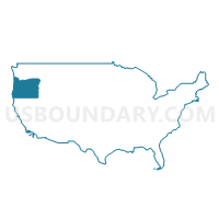
Outline
--Ashland+City+PUMA%2c+Oregon_A280.png)
Summary
| Unique Area Identifier | 193822 |
| Name | Jackson County (Outside Medford & Central Point Cities)--Ashland City PUMA |
| State | Oregon |
| Area (square miles) | 2,727.64 |
| Land Area (square miles) | 2,710.28 |
| Water Area (square miles) | 17.35 |
| % of Land Area | 99.36 |
| % of Water Area | 0.64 |
| Latitude of the Internal Point | 42.41178200 |
| Longtitude of the Internal Point | -122.67579740 |
Maps
--Ashland+City+PUMA in Oregon.png)
Graphs
Select a template below for downloading or customizing gragh for Jackson County (Outside Medford & Central Point Cities)--Ashland City PUMA, Oregon
--Ashland+City+PUMA%2c+Oregon_T0.png)
--Ashland+City+PUMA%2c+Oregon_T1.png)
--Ashland+City+PUMA%2c+Oregon_T2.png)
--Ashland+City+PUMA%2c+Oregon_T3.png)
--Ashland+City+PUMA%2c+Oregon_T4.png)
--Ashland+City+PUMA%2c+Oregon_T5.png)
--Ashland+City+PUMA%2c+Oregon_T6.png)
--Ashland+City+PUMA%2c+Oregon_T7.png)
--Ashland+City+PUMA%2c+Oregon.png)
Neighbors
Neighoring Public Use Microdata Area (by Name) Neighboring Public Use Microdata Area on the Map
- Del Norte, Lassen, Modoc, Plumas & Siskiyou Counties PUMA, CA
- Douglas County PUMA, OR
- Jackson County (Central)--Medford & Central Point Cities PUMA, OR
- Josephine, Coos & Curry Counties PUMA, OR
- Klamath, Malheur, Lake & Harney Counties PUMA, OR
Top 10 Neighboring County (by Population) Neighboring County on the Map
- Jackson County, OR (203,206)
- Douglas County, OR (107,667)
- Josephine County, OR (82,713)
- Klamath County, OR (66,380)
- Siskiyou County, CA (44,900)
Top 10 Neighboring County Subdivision (by Population) Neighboring County Subdivision on the Map
- Medford CCD, Jackson County, OR (127,868)
- Grants Pass CCD, Josephine County, OR (59,908)
- Ashland CCD, Jackson County, OR (30,170)
- Southwest Jackson CCD, Jackson County, OR (11,176)
- Eagle Point CCD, Jackson County, OR (10,474)
- Cave Junction CCD, Josephine County, OR (7,994)
- Northwest Jackson CCD, Jackson County, OR (7,258)
- Shady Cove CCD, Jackson County, OR (6,921)
- Sams Valley CCD, Jackson County, OR (4,686)
- South Umpqua CCD, Douglas County, OR (4,467)
Top 10 Neighboring Place (by Population) Neighboring Place on the Map
- Medford city, OR (74,907)
- Ashland city, OR (20,078)
- Eagle Point city, OR (8,469)
- White City CDP, OR (7,975)
- Talent city, OR (6,066)
- Phoenix city, OR (4,538)
- Shady Cove city, OR (2,904)
- Jacksonville city, OR (2,785)
- Rogue River city, OR (2,131)
- Gold Hill city, OR (1,220)
Top 10 Neighboring Elementary School District (by Population) Neighboring Elementary School District on the Map
- Hornbrook Elementary School District, CA (712)
- Klamath River Union Elementary School District, CA (484)
- Seiad Elementary School District, CA (328)
Top 10 Neighboring Secondary School District (by Population) Neighboring Secondary School District on the Map
Top 10 Neighboring Unified School District (by Population) Neighboring Unified School District on the Map
- Medford School District 549, OR (84,505)
- Three Rivers School District, OR (47,713)
- Klamath County School District, OR (42,784)
- Central Point School District 6, OR (29,667)
- Eagle Point School District 9, OR (27,686)
- Ashland School District 5, OR (24,282)
- Phoenix-Talent School District 4, OR (24,064)
- Rogue River School District 35, OR (9,283)
- Glendale School District 77, OR (2,981)
- Days Creek School District 15, OR (1,214)
Top 10 Neighboring State Legislative District Lower Chamber (by Population) Neighboring State Legislative District Lower Chamber on the Map
- Assembly District 2, CA (469,582)
- State House District 55, OR (66,629)
- State House District 4, OR (63,740)
- State House District 6, OR (63,496)
- State House District 3, OR (63,226)
- State House District 2, OR (61,776)
- State House District 5, OR (61,343)
- State House District 7, OR (59,574)
- State House District 56, OR (59,231)
Top 10 Neighboring State Legislative District Upper Chamber (by Population) Neighboring State Legislative District Upper Chamber on the Map
- State Senate District 4, CA (988,287)
- State Senate District 2, OR (126,966)
- State Senate District 28, OR (125,860)
- State Senate District 3, OR (124,839)
- State Senate District 4, OR (122,124)
- State Senate District 1, OR (120,277)
Top 10 Neighboring 111th Congressional District (by Population) Neighboring 111th Congressional District on the Map
- Congressional District 2, OR (769,987)
- Congressional District 4, OR (739,234)
- Congressional District 2, CA (708,596)
Top 10 Neighboring Census Tract (by Population) Neighboring Census Tract on the Map
- Census Tract 14, Jackson County, OR (10,474)
- Census Tract 7, Jackson County, OR (9,399)
- Census Tract 13.02, Jackson County, OR (8,950)
- Census Tract 3616, Josephine County, OR (8,348)
- Census Tract 9, Jackson County, OR (8,171)
- Census Tract 18, Jackson County, OR (7,817)
- Census Tract 17, Jackson County, OR (7,322)
- Census Tract 29, Jackson County, OR (7,258)
- Census Tract 3613, Josephine County, OR (7,088)
- Census Tract 27, Jackson County, OR (6,921)
Top 10 Neighboring 5-Digit ZIP Code Tabulation Area (by Population) Neighboring 5-Digit ZIP Code Tabulation Area on the Map
- 97504, OR (44,444)
- 97501, OR (42,117)
- 97526, OR (34,205)
- 97527, OR (33,713)
- 97502, OR (27,694)
- 97520, OR (24,469)
- 97601, OR (22,459)
- 97524, OR (14,459)
- 97503, OR (10,528)
- 97540, OR (7,930)